|
|
Research Materials
|
|
EOC_EO1_report_Final (18MB)
|
Final Report to NASA for the CSIRO Australia participation in the EO1 Science Validation Team 2000-2003
|
|
Information_on_the_FTP_site
|
Map of the information incuded in the EOC Workshop on Hyperion Hyperspectral Science
|
|
Download Zip File of the CSIRO Workshop Materials (16MB)
|
The EOC Workshop on Hyperion Hyperspectral Science was held in March 2002 and later repeated due to increasing demand. It aimed to bring EOC scientists up to date with materials needed
for research into the EO1 mission and (in particular) the Hyperion Hyperspectral sensor on board. After nearly 20 years, the Workshop notes and
ancillary materials may still be useful for anyone wishing to analyse Hyperion data for non-profit R&D. The software will not work with ENVI 5. If interested contact the web site manager.
|
|
NWU Linear Systems Seminar 2018
|
The Linear Systems Seminar was held at Northwest Universty in Xi'an in November 2018. This material was provided before David Jupp went to China.
It was augmented by additional material during his stay and over the weeks of presentations. It is planned for the site to be updated to
include all of the material as presented and discussed, and to be signficantly updated if/when the Seminar is run again in a post-COVID19 world.
|
Fr. David in the Qinling
An important current project relates to the
visit of the French missionary Monsieur L’Abbé Père Jean Pierre Armand David
(CM, 1826-1900, 谭卫道, Tan Weidao) to Hanzhong in 1873. Fr. David (Fr. Stands for “Frater”,
“Frère” or “Brother” as a general term for a Member of
a catholic order) was a natural scientist who made three journeys to China and “discovered”
many animal and bird species such as the Panda and the Père David’s deer. His third “voyage”
included areas on the north and south of the Qinling. In coming to Hanzhong
from the Guanzhong he travelled the old road previously called the Baoxie Road.
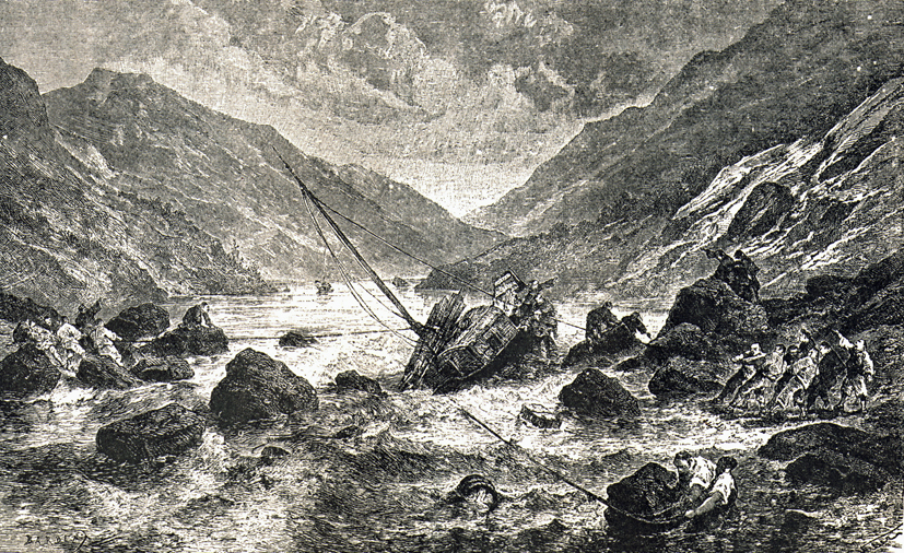
In Hanzhong he also made geological and biological discoveries before setting
off on the Han River for Hankou. He was unfortunately boat-wrecked but was
unharmed. His diary of the third visit was published as:
David, M. L’Abbé Père Armand (1875). Journal
de mon troisième voyage d’exploration dans L’Empire Chinois. 2
volumes, Paris, Libraire Hachette et Cie.
The Table below provides access to a number of documents and
materials. First, two PDF files of his diary (Vol 1 and Vol 2) are included. If
the printed books are needed they can be provided by post. The files are searchable.
Next, a PDF file has been included with two extracts from a document by DLBJ
that has been in progress for some years. Material from the draft document has already
been used in other documents such as the
“Shu Roads Introduction”
and
“Catholics on the Shu Roads”
to be found on this Qinling Plank Roads to Shu web site. The two extracts included here are a general
introduction to Fr. David and his visits to China and a description of the
journey along the Baoxie Road. The initial studies now have a separate web page to be found
HERE.
The expeditions in the north and south of the Qinling have also been presented as a
Google Earth KML file. This KML file and the Word document version of the two
extracts above have been bundled as a ZIP file for use and information. The draft
document also has material covering Fr. David’s work in the northern Qinling
and some of the activities in Hanzhong and on the Han River. These last
sections are incomplete and the subject of current work.
|
|
Travels of Fr. Armand David in 1873
|
|
Journal_de_mon_troisieme_voyage_v1.pdf (10MB)
|
Searchable PDF of Volume 1 of Fr. David's third voyage to China:
M. L’Abbé Père Armand David (1875). Journal de mon troisième voyage d’exploration dans L’Empire Chinois. 2 volumes, Paris, Libraire Hachette et Cie.
|
|
Journal_de_mon_troisieme_voyage_v2_search.pdf (10MB)
|
Searchable PDF of Volume 2 of Fr. David's third voyage to China:
M. L’Abbé Père Armand David (1875). Journal de mon troisième voyage d’exploration dans L’Empire Chinois. 2 volumes, Paris, Libraire Hachette et Cie.
|
|
Travels_of_Fr_David_v3_final.pdf (1.3MB)
|
PDF of Final Version 3 of the document for Fr. David's travels in China on the Baoxie Road in 1873 from the north to the south of the Qinling at Hanzhong.
|
|
David_Qinling
|
This activity now has a web page to be found
HERE
. It is planned to extend it with information on the routes travelled by Fr. David and also to include translations of the nortern Qingling activity and
his stay in the Han River Basin.
|
The Kangxi Maps and the Chamadao
A second area of interest and development is suported by a set of references to published papers
or documents. They cover some previous work by various people that provide important background information
for the question we are asking about a path taken by Jesuit and Chinese map
makers in their survey of Shaanxi. The surveys occurred between 1712 and 1714 as part of the work leading to
the "Kangxi Maps". Some additional information about the Kangxi Maps can be found on this web site under the
"Kangxi Jesuit secret map of 1721".
The first two papers in this Table are PDF files of papers published by
DLBJ on the Kangxi maps and on the projections of the European copies of the
Kangxi maps. The third and fourth are versions of a Chinese paper, published in 1990, by
Wang Qianjin (汪前进). He
proved that the projection of the Copperplate Kangxi Map was sinusoidal. This
was used in the first two papers by DLBJ. The third paper is the Chinese language version and the
fourth paper is a translation of the third paper into English so that English speakers
can see what he did.
The fifth document is Wang Qianjin's PhD Thesis. It is very comprehensive but only available in Chinese.
The sixth paper in the Table is one published by a Prof. Han
Qi (韩琦) in a book about the
Kangxi maps and the European maps that were developed from them. Unfortunately,
Prof Han’s paper seems only to be in English. Footnote 1 of the paper says:
“The author is Professor in the Institute for the History of
Natural Sciences, Chinese Academy of Sciences. Professor Han Qi's essay has
been translated from Mandarin Chinese into English by Annie Lam.”
If the original Chinese version of the translated paper can
be found it will be a very significant step. The translation is not easy to use
to find Chinese references and some hard to understand areas will certainly be
resolved by looking at the Chinese language. It is much better to read what the
Professor wrote in order to truly appreciate his information. So, possibly the
first step of the Project is to find where these people are now and to see if
the Professor’s paper was ever made available in Chinese? If the Chinese version
exists, it will help us all
to undertake the planned work. Prof. Han and Prof. Wang Qianjin were both at the
Research Institute for History of Natural Science, Chinese
Academy of Sciences. (
中国科学院自然科学史研究所)
The seventh paper is by some young people at the Centre for
Historical Geographic Studies, Fudan
University, Shanghai, China. They repeated the work of Wang Qianjin but sought
to apply statistical methods that may be applied to other situations like this
on. Perhaps they know where the original authors can be found?
These six papers and PhD Thesis provide the background. Perhaps the first
step is to become familiar with the Kangxi maps and their history and then look
at some specific questions regarding the surveys in Shaanxi and possibly Sichuan?
|
|
The Kangxi Map and the Chamadao
|
|
jupp_Cartographica_52.3_Kangxi_Map.pdf (26MB)
|
Paper published in Cartographica by David Jupp reference:
Jupp, David L.B. (2017). Projection, Scale, and Accuracy in the 1721 Kangxi Maps. Cartographica, 52(3), 215-232. (DOI:10.3138/cart.52.3.2016-0004)
|
|
jupp_Globe_NLA_24pp_1-24a.pdf (11MB)
|
Paper published in the Globe by David Jupp concerning the European copies of the Kangxi map. Reference:
David L. B. Jupp (2018). Determining projection and scale for
maps in early atlases of China held by the National Library of Australia. Journal
of the Australian and New Zealand Map Society Inc., 84, 1-24.
Google Earth presentations of the maps described in the paper (as direct links) can be found
HERE.
|
|
Wang_Qianjin_draft_CH.pdf (500KB)
|
Chinese version of the paper published by Wang Qianjin on the projection used in the Kangxi Map. Reference:
Wang, Qianjin (1991). A new investigation of the projection of the copper plate version of the Kangxi “Complete map of the imperial domain”, Studies in the History of Natural Science, Vol. 10 No. 2 (1991) (In Chinese)
康熙铜版《皇舆全览图》投影种类新探; 汪前进(者)《自然科学史研究》笫10卷第2期(1991年):186一194。
|
|
Wang_Qianjin_draft_EN.pdf (600KB)
|
English (translated) version of the paper published by Wang Qianjin on the projection used in the Kangxi Map. Reference:
Wang, Qianjin (1991). A new investigation of the projection of the copper plate version of the Kangxi “Complete map of the imperial domain”, Studies in the History of Natural Science, Vol. 10 No. 2 (1991) (In Chinese)
康熙铜版《皇舆全览图》投影种类新探; 汪前进(者)《自然科学史研究》笫10卷第2期(1991年):186一194。
|
|
Wang_Qianjin_1990_Thesis_v4.pdf (12MB)
|
Editable Doctoral Thesis by Wang Qianjin on Kangxi Maps including the projection used. Reference:
Wang, Qianjin (1991). Research into the cartographic surveys and the Kangxi “Complete map of the imperial domain”, PhD Thesis (In Chinese)
《皇舆全览图》测绘研究,汪前进(者),博士论文,中国科学院自然科学研究所,1991年。
|
|
Cartography_during_the_Times_of_the_Kang.pdf (7MB)
|
Paper by a Chinese expert on the times of the Jesuit astronomers and cartogrophers and the Chinese developments of the times. Prof. Qi Han published this paper in English as
part of a Symposium. The paper notes it was translated by a Chinese named Annie Lam. However, the Chinese version has (unfortunately) not yet been found. It has many references
to Chinese papers and books but they are hard to find without having a full and complete reference in Chinese. The material is very important to understand the Chinese context of the
Kangxi Maps. Reference:
Han Qi 韩琦. 2006. "Cartography during the times of the Kangxi
Emperor: The age and the background." In Jesuit mapmaking in
China: D’Anville’s Nouvelle atlas de la Chine (1737), ed. R.M.
Ribeiro and J.W. O’Malley, 51–62. Philadelphia: Saint Joseph’s
University Press. [English translation of Chinese manuscript by
Annie Lam].
|
|
Lu_etal_2011_Shanghai_Projection_Stats.pdf (600KB)
|
Paper by researchers at the Center for Historical Geographic Studies,Fudan University,Shanghai, China. They repeat the work on the projection for the
Kangxi Map by Wang Qian but apply general statistical methods to prove his conclusion.
Reference:
Lu Junwei, Han Zhaoqing, Zhu Xuanlin, and Qian Hao. 2011.
陆俊
巍,韩昭庆,诸玄麟,钱浩者,康熙《皇舆全览图》投影种类的统计分析
[A statistical analysis on the projection type applied in Huang Yu
Quan Lan Tu]. 测绘科学[Science of surveying and mapping] 36
(6): 16–27. [In Chinese].
|
 https://orcid.org/0000-0002-9467-1344