Report on a visit to China in May 2008 (originally) to prepare the Collected Papers of a Symposium
David L B Jupp
1 The Dragon Gate opens
At 14:28 (2:48 pm) on May 12, 2008 a near-surface grade 7.8 earthquake occurred in Wenchuan County (汶川县) to the northwest of Chengdu, the capital of China’s Sichuan province. Shock waves from the earthquake spread north through the Longmen (龙门, Dragon Gate) mountains to Beichuan (北川) and Qingquan (青川). They then spread further north into Shaanxi through Lueyang (略阳) and on to Tianshui (天水) in Gansu and to the east through Guangyuan (广元) and Hanzhong (汉中). They bounced a vehicle travelling out of Hanzhong towards Xi’an along the new Xihan Tollway. They continued with ever increasing period and reducing force until, like the Manly Ferry crossing Sydney Heads is swayed by the ocean swell, the long period earth swell swayed the tall buildings in Beijing and Shanghai. The swaying sent people working and living there into panic. The result of this earthquake and its aftershocks is a disaster than has claimed the lives of more than 60,000 people and left more than 5 million homeless. The first shock had the same strength as the Tangshan earthquake of 1976 but although it has (thankfully) claimed fewer lives, the destructive power of the Wenchuan earthquake and the subsequent damage in Yunnan, Sichuan, Shaanxi and Gansu has been much greater.
I was in the car on the road to Xi’an near Yangxian after a successful time at Hanzhong readying the Collected Papers from a Symposium in May 2007 for the publisher. The driver did well to control the car as the waves moved through the road. He then turned off into a brand new service area being prepared for the anticipated increase in tourism to follow the games in August and September. After calls to Hanzhong (where we had started) and Xi’an (where the driver and young man were heading) we started off again to drive through some of China’s longest tunnels under the Qinling Mountains to the Wei River valley. If I had known how large the earthquake had been, I would have been more anxious. There was water over the tunnel floor in places, which I found surprising and there was much less traffic that I had anticipated, but otherwise things seemed normal. When we emerged from the tunnel there were three text messages asking if I was OK and when we arrived at my destination, in the University town of Yangling, 80km west of Xi’an, the people were in the street and land line communications were down. The millions of mobile phones (especially CDMA) were the backbone of China’s communication as news trickled in saying that many areas had been affected and people desperately sought information about friends and family. That night, most people slept outside. I was so tired that by midnight I decided bed was best and slept well, not even waking for the (small) aftershock at about 4:00am.
|
|
|
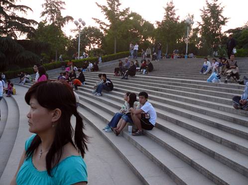
Anxious students from NW University of Forestry and Agricultural Technology take up positions in the open for the night following the earthquake while Xie Hongxia and I wait for Li Rui. Yangling was relatively safe, but people had been shaken and took no chances sleeping in their dormitories. |
Within 12 hours of the event, China mobilised. Premier Wen Jiabao went to Sichuan overnight to be on the spot and coordinate the national response. The PLA and teams of medical and emergency professionals from all over China were rushed to the scene by air force transport. But at the site of the devastation, unstable buildings, landslides and floods threatened the rescuers. The roads had been cut, airstrips destroyed and the main arterial roads and railways had been swept away. At least one train on the Baocheng railway was crushed by a landslide and tunnels destroyed. Troops parachuted into isolated areas and used every form of transport including ultra-light aircraft, helicopters and inflatable rafts to reach victims and survivors. In the harsh conditions, rescuers were also lost. The slogan adopted by CCTV for the period of the emergency was “resist the earthquake, rescue (the people) from calamity; in unity is strength” (抗震救灾;众志成城). The use of the characters “Kangzhen” for “resist the earthquake” carried added weight. “Kangzhan” (抗战) is the abbreviation used for 抗日战争, the war of resistance against Japan, fought between 1937 and 1945.
Geology provides some explanations but no comfort. The earthquakes originated in a major thrust-fault in the Longmen Mountains which run north-south on the western margin of the Sichuan plain. To the west of the Longmen Mountains is the Qinghai-Tibet plateau which has been responding over geological time to the collision between the Indian subcontinent and the Eurasian continent. To the east of the Longmen Mountains lie the north and south China blocks. The point of collision between the China blocks created the east-west trending Qinling and Daba Mountains. The areas are tectonically active and large earthquakes have occurred before. The shock of the movement seems to have been transmitted rapidly through the mountain regions and caused huge damage and destruction. On the deeper alluvial plains, such as the Chengdu Plain, the Hanzhong basin and in the Guanzhong (Wei River valley where Xi’an is located and there are deep loess soils), the shock seems to have been less damaging. Where there was a combination of high population density and mountains, such as at Mianyang and Guangyuan in the northern area of Sichuan the disaster was greatest. Since the initial earthquake, which was centred in Wenchuan County, there have been some significant aftershocks. One at grade 6 was centred near Jiangyou and Beichuan north of the first event and on May 24, a grade 6.4 aftershock occurred further north near Qingquan and Guangyuan. The northern movement did not stop. On May 27, three new aftershocks occurred in Ningqiang County to the northwest of Guangyuan at the southern edge of Shaanxi province of grades 5.4, 3.7 and 5.7. The task of recovering from these events will take years.
2 Spring Weather in Hanzhong
2.1 Rapid Transit to Yangling
On the morning of May 5, 2008 I left Sydney bound for Shanghai. Once there, I changed to a domestic flight and finally arrived at Xianyang airport (near Xi’an in Shaanxi). There I was met by cheery students to take me to Yangling by about 0200 early on May 6. Later that day, after a sleep, I met Li Rui and we formulated a plan for the Plank Roads and Australia-China Council Project component of the visit[1]. Basically, I would go to Hanzhong by road along the former Baoxie Plank Road with an old friend Driver Zhang (who is the son of an older friend), as well as Hu Rongming (胡荣明) from The University of Science and Technology in Xi’an and a student, Cao Jianxia (曹剑侠). Hu Rongming and Cao JIanxia had both come with me on a previous GPS mapping mission along the former Jinniu road to Chengdu in October, 2007. When we reached the new study area, Hu Rongming and I would decide what work plan would be feasible for the planned field work to support our pilot project. The study area had been selected as being between Jiangkou and Jiangwozi where the ancient Baoxie road met the Lianyun road. Our task on this occasion was to ascertain whether it is possible to identify the sections where the former Plank Roads were located and what scale of digital terrain mapping was necessary for the work.
|
|
|
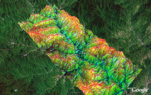
3D model of study area using SRTM data processed to a DTM with slope and curvature and imported into Google Earth for visualisation. |
In Hanzhong, Hu Rongming, Cao Jianxia and Driver Zhang would leave me and return to Xi’an and Yangling. The primary objective of the Hanzhong visit was to work with Director Feng Suiping of the Hanzhong City Museum to collate all of the papers from the May 2007 “Symposium on Plank Road Research and Applications of 3S Technology” for publication. There were many things that needed to be done before it could go to the printer. These included proof-reading, translations of titles, table of contents, introductory and closing speeches and summaries and other editing. I was also taking with me a draft Google Earth presentation of maps of the main Shu Roads and wished to discuss a number of questions with the people at the Museum. This draft material is to be upgraded when the basic paths and places along the routes have been validated. It will include photographs, historical summaries, images and other information which have been collected but not embedded until the basic framework is validated. The draft can be found at the ACC Project Website if you are interested to look at it.
2.2 Evaluation of the Pilot Study field work
We moved quickly along the Baoxie road, only pausing to re-check some GPS locations and names acquired on a previous visit. After moving into the study area it was obvious that the task of locating the sections where there were Plank Roads was not easy. Using terrain models and maps it is possible to reduce the area of possible relics significantly but the vegetation covering the sides of the steep cliffs was thick and hard to penetrate. The GPS, even with a roof aerial, often had difficulty finding four good satellites in the steep sided valleys and its base accuracy indicated that in the locations where the Plank Roads occurred there would need to be augmentation either by ground survey (such as by using a total station) or with DGPS. These findings will be written into the work plan.
|
|
|
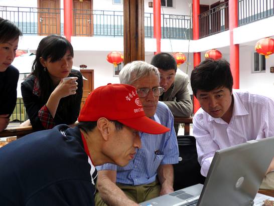
Demonstrating 3S technology by battery power while the Bao River fish cooks |
We felt that people at the Zhang Liang Temple may already have mapped some of these places and be able to reduce the task considerably. This turned out to be so but I did not meet the people involved until later when I went to Zibai Mountain on May 11. People from the Temple came to see us and discussed our ideas and plans with great interest. While we waited for a lunch of Bao river fish to be prepared, I used the laptop to present the scope of our work and our plans. It was reminiscent of the meeting I had with the Director of the Zhang Liang Temple in 2005 at another restaurant and as before it spoke much more lucidly than I could with my limited Chinese. After lunch, the Zhang Liang Temple staff took us back along the river to a relic site we had not previously seen. It was called Daoshuiwan (倒水湾) and the Plank Holes were able to be seen only at some risk down a steep cliff-face where I located the new GPS waypoint. Along this stretch of the study area it would certainly be possible and useful to use inflatable dinghies to map and measure the track of the Baoxie Plank Road. We then went to the Temple and saw that it had continued to prosper since previous visits. Hu Rongming and Cao Jianxia had not been to the Zhang Liang Temple before as we had not stopped there in the previous visit. We had travelled during the National Day Holiday (October 1-8) when all of the temples and museums and relic sites were filled to overflowing with Chinese people travelling on newly built highways to discover their past and cultural heritage. This time, on a normal week day, it was not so crowded.
|
|
|
|
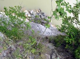
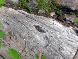
Plank Road relics at Daoshuiwan |
Plank hole closeup |
The road to Hanzhong was filled with trucks as it has been every time we travelled along this way. I wondered why the new tollway from Hanzhong to Xi’an had not made a difference. I later found out that, following some accidents in the tunnels, trucks have mostly been banned from the new Tollway. When I later travelled through its long (up to 18km) tunnels I was very glad that there were no trucks. Eventually, we reached Hanzhong where we were warmly welcomed and rested for the next day. In the morning, the three others left for Xi’an after breakfast and I was left with my rudimentary Chinese to help complete the work!
2.3 Completing the “Collected Papers”
Director Feng had hoped that the Symposium papers would be ready for the printer during March but there were some delays from my side and by early May the need was urgent. The Provincial Government was providing support for the publication and was getting a little impatient. So we set to work.
The “The International Symposium on Historical Research of Plank Roads and Applications of 3S Technology” (栈道历史研究与3S技术应用国际学术研讨会) was held in Hanzhong in May, 2007. A range of experts in remote sensing, geographic information systems and GPS technology from USA, Australia, New Zealand, Taiwan and Hong Kong attended. These people provided the Chinese historians and archaeologists with information on how “3S” technology could support their historical work. There was great interest in the excellent presentations delivered in this segment of the Symposium. Following the Symposium, most of the guests agreed to provide papers for a formal proceedings and Director Feng obtained significant support from for its printing. However, during the visit I made in October, 2007, Director Feng expressed the opinion that it would be best if all of the English language papers were also in Chinese. This would definitely increase the impact of the Symposium in China. The Chinese papers would still only have the abstracts in English and Chinese. I agreed that this would increase the impact both in China and western countries and we set about organising the additional translations and to re-check the English abstracts for the Chinese papers.
In the end it took longer than we estimated. There were many reasons for the delay and one of these was that, in addition to the translations of the English language papers as presented at the symposium, the paper that I, Brian Lees, Feng Suiping and Li Rui had presented on the progress of the Australia-China Council Project was rewritten into two parts. One part introduced Plank Road history and geography for English language readers and a second part aimed to draw together the set of papers presented on 3S technology into some general context. These papers covered a wide range and together provide an excellent set of discussions of the topic. It seemed a good idea to try and put them in such a context. The additional work this created for the translators added to the overall delay but I hope this decision has also added value to the final publication.
We worked hard to complete the editing, checking, translating and collating. Some material sent by email had not been received and some sections had not previously been translated or edited. We fortunately had the support for some of this from Mrs Wang Juan (王娟), an English language interpreter working for the Hanzhong Government. She had accompanied a delegation to Europe the previous year. The delegation included Feng Suiping and she had gained an interest in Plank Roads and the Museum’s cultural relics from the presentations he made on the visit. Her presence in Hanzhong has already been invaluable for delegations visiting from Australia. She told me with great enthusiasm of a recent visit by a delegation from Sydney local government and in particular of the Mayor of Auburn City Council, Cr. Le Lam. Cr. Lam can speak Chinese and showed a lot of interest in increasing interactions with Hanzhong.
|
|
|
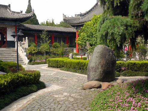
After lunch and working on the collected papers you can sit in the Museum gardens and think or read or relax or all three. Spring in Hanzhong. |
We did not finish until late on Saturday May 10 and by then we were weary of it. At the beginning we had a number of helpers, but by late on Saturday Feng Suiping and I finished it by ourselves! But it was finally finished and ready to send to the publisher in Xi’an. I have brought back a copy, converted it to PDF and made it available on the ACC Project Website if people are interested. As the publisher will also have many questions, it may be best to wait for the published version unless you are an author (in which case you should check your papers) or especially interested in Plank Road history. But I must say I did enjoy being there and working on the publication. The publication will be very valuable and after lunch everyday there was also time to rest and enjoy the calm and beautiful gardens and ponds of the Museum.
2.4 Climbing Zibai Mountain
At dinner on Saturday night we discussed when I should return to Yangling and whether there was anything else I wished to get done. I decided I should return on Monday May 12 because there were other things that I needed to do and on this visit to Hanzhong the main objectives had been achieved. Still, there was the chance to do something interesting as well. We decided that it would be possible to go back to the Zhang Liang Temple and from there to climb the 2500m Zibai Mountain (紫柏山 or Purple Cedar Mountain).
|
|
|
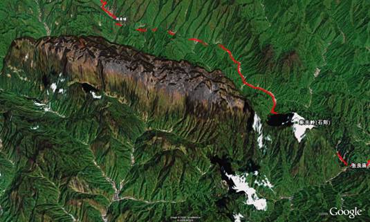
Zibai Mountain in Google Earth showing its “Tortoise” shape, its relatively flat top with grassland and its distinctive appearance in the background of the Qinling Mountains. The Zhang Liang Temple is on the right at the edge of the image. The red line is a GPS track from the visit in October 2007. |
The mountain is very famous for its caves and the alpine grassland that occurs on its flat top. The ecology is unique, its fauna abundant and its sides are precipitous. I felt this would interest many people who are keen on adventure tourism in Australia. Its geology is also unusual and it is either a very ancient relic or a recently up-thrust piece of Karst (limestone and sandstone) which is totally unlike the surrounding terrain. Its oval shape has associated it with the sacred Tortoise and it has been a place where daoists have meditated and armies hidden. It seemed like a good thing to find out more about.
There was another reason to go to the mountain. I had been reconciling GPS data we have taken with the SRTM (Shuttle Radar Topography Mission) digital elevation data set. It is the base 3D terrain information used in Google Earth. Basically, the two data sets are consistent in baseline and accuracy with some major differences easily attributed to differences in scale, poor GPS accuracy in deep valleys and tunnels. But when I digitised some contours from the Russian maps I found the baseline changed with altitude and there were some significant differences. What I needed was a GPS transect with a significant height difference from base to summit and going up to an altitude of over 2000 metres. Here was the chance!
There was some confusion at the start but suddenly two young people from the Museum were “drafted” to accompany me. One was Wang Danqing (王丹青) and the other Xu Yang (许阳). Xu Yang is a guide at the Museum and has excellent English, having recently graduated from the Cambridge English College (a coaching school) in Hanzhong. Wang proved to be a great asset during the climbs up and down the mountain! We took a further look at the Zhang Liang Temple where I learned that one of the Steles was from the Song period and also met old Mr Chen and his daughter who had compiled the first map of the Plank Roads I saw in a book I had bought 10 years previously. They could well provide us with the information we need in the study area, but it will need more than a passing visit.
We had a very pleasant lunch and then headed to the start of the Zibai “scaling ladder” (紫柏云梯). The photographs can be viewed on the ACC Project Website. The GPS track with embedded photographs has also been assembled but it is not yet available on the website as there are some issues with very dense GPS tracks in the current version of Google Earth. This is being resolved. But the view and climb were truly amazing. The air was clear and the day fine, the young people were determined to climb to the top and we made it there with great relief. The only down side was the presence of too much “white pollution” (such as plastic) on the top and no provision for its collection or removal. More will be said about this later. Making it down the mountain was also interesting as the photographs will show – but who knows in what state the steep stairs are now?
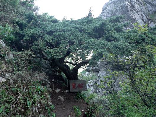
Another interesting thing that can be found near the top of Zibai Mountain is the presence of naturally occurring bonsai trees such as the one in the following photograph.
|
|
|
Natural Bonsai Purple Cedar tree on Zibai Mountain |
Then it was back to Hanzhong, stopping at the Shimen dam where restaurants with tables near the water could have been at the seaside in any resort. It had been a very tiring day but also a very satisfying one.
2.5 Google Earth Maps and 50 years to celebrate
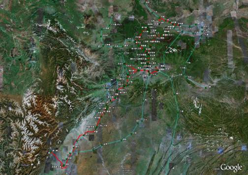
There had been little time to go through the Google Earth maps and check paths and places. However, on Monday May 12 I was able to oversee Google Earth being installed by He Jian (何建) and to download a large amount of imagery, GPS and other data onto the best graphics computer that the Museum had. The extent of the Shu Road maps covers an area from Baoji and Tianshui in the north to Chengdu and Dujiangyan in the south as shown below. The KMZ file of these data can also be accessed on the ACC Project Website. As we worked, we were not to know that the western side of the Shu Road region in our map would be a major disaster zone within a few hours of our discussions.
|
|
|
The Shu Road draft maps presented in Google Earth for checking and editing. |
He Jian had also been working with us on the Symposium papers and has a deep knowledge of history and archaeology as well as excellent facility with computer systems and modern technology. He is a great asset for our work and will liaise with Hu Rongming during the Pilot project. Cao Li (曹丽) also discussed with me a request from the Hanzhong Tourism Bureau asking for comments on how to improve Hanzhong Tourism to be forwarded from foreign guests. I made some suggestions, with help to translate them from Xie Hongxia in Yangling and gave particular attention the the “white pollution” and its potential impact on western tourism. It is included here as an Appendix but maybe now it is not relevant now. Or perhaps it is more relevant – time will tell.
Feng Suiping was especially keen to obtain the 1:100,000 digital Russian maps that I had purchased. These were based on pre-1965 aerial photography and showed roads along the side of the Bao River that had been in use since 1943 and only replaced since 1965. They had also been compiled prior to recent major changes brought about by water management and show terrain contours in places where there are now major dams. They are a valuable modern historical record. We also needed to discuss the plans being made for the celebration of the 50th anniversary of Hanzhong Museum (五十年馆庆). It is being combined with a conference on the “Thirteen Shimen Inscriptions” (石门汉魏十三品) which are a set of famous inscriptions from the Han and (Northern) Wei periods that were removed to the Museum for preservation from the ancient Stone Gate tunnel when the Shimen Dam was built. The big day will be October 18 after the National Day holiday. The conference will also include the inscriptions and stele of the Shu Roads. It was to be a big event and it seemed to be a point of focus at the time.
Finally, we sorted out some of my most pressing questions about the Shu Roads and left the detailed checking to be done later and discussed by email. How could we know? We simply had a happy and satisfied lunch, said goodbyes and I headed for Xi’an and Yangling with two companions along the Xihan Tollway.
3 From Rescue to Rebuilding
The “war” analogy of the slogans seemed appropriate at first but it does not really describe what happened. The Chinese people responded to the plight of the victims in a similar way to, but with greater intensity than, the response of Australians to the Asian Tsunami. Donations poured into the Red Cross. The following appeal was posted on the web: “If you cannot wait but have no cash at hand, please send support as follows: write a text message consisting of “1” or “2” and send it to 1069999301 to support the Red Cross operations! (You can send any number of donations)”. This may not sound like a lot of money but when you consider the number of mobile phones in China and multiple messages it becomes a fast and significant flow of donations into the Red Cross account. This immediate trickle quickly became a torrent.
Everyone who had access to TV or internet was strongly affected by the images and stories of desperation and bravery that flowed from the disaster area during the first few hours and days. The early TV was very graphic being from the “front-line” and brought to air by local TV crews and amateurs who often took part in the rescue. Soldiers parachuting into mountainous areas and boats and dinghies fighting turbulent rivers to reach villages were presented as they happened and without embellishment or editing. In one segment, the police were collecting lists of mobile phone numbers and calling the missing people “live” on the TV. It was horrifying as among the calls that were answered were desperate people who in some cases had little hope of rescue. Images of the bodies of the Dujiangyan school children lying in the open horrified people all over the world. Teams of doctors, nurses and ambulance drivers as well as emergency workers and PLA units flew in from all over the country to the rescue area. Sometimes what they found was more than they could bear. My feeling was that what happened was based on love of fellow countrymen. It was not orchestrated or premeditated. It was spontaneous, non-discriminatory, unqualified and from the heart.
Foreign responses were also immediate as experienced earthquake rescue teams from Japan, Korea and Singapore arrived with Russian and Indian teams following soon after. The foreign press moved in as soon as it was possible to reach the victims and pictures were transmitted to the world by satellite phone. Donations poured in from five continents. As all this happened, I received a text message from someone I did not know. Perhaps it was the Red Cross or someone at the Institute or just a widely broadcast text message. It was a poem or prayer or both that seems to sum up the hopes of all Chinese people at that time as well as today. In English and Chinese it went as follows:
|
Hope that the earth will not part again, That the sky will not be overcast and grim; Pray that the tragedy will not repeat, That people find safety from calamity; Hope that the misfortunes have left us, Believe that things will get better, After all, just being alive is a blessing. |
希望大地不再有裂缝, 天空不再阴冷; 祈祷悲剧不要重演, 人民平安度过灾难; 希望不幸的事都会过去, 相信一切都会好起来的, 毕竟活着就是幸运! |
I completed what I could and what seemed relevant in the circumstances in Yangling and moved on to Beijing. By this time, TV crews from the east coast had arrived. The sophisticated technology of the production was impressive but it was also somewhat less “real” than before. I knew what the reality was from the images captured by the provincial cameramen as they worked to rescue victims in the first hours. But in Beijing I was certainly pleased to see the wealth of spatial data and remote sensing that was rapidly brought to bear to inform the public and guide the efforts of the rescuers. In the area that the earthquake struck, the existing maps and gazetteers were inaccurate but the need to provide accurate coordinates so that paratroops could safely land at a target or to guide ground troops through the changed terrain to the disaster sites when man-made features such as roads were obliterated was imperative. All spatial data groups, including those I knew at the CAS Institute of Remote Sensing Application were working seven days a week to provide information from any and every source they could access. The visualisation and analysis on the TV was of high calibre and well informed. Our technology can help save the lives of victims and rescuers alike if it is brought to bear in time.
At some point, of course, rescue of the victims must give way to rebuilding the lives of the survivors. China is moving into this phase even though aftershocks are making it hard and as landslides continue, barrier lakes threaten remaining towns and people face the ever present threat of disease and limited access to medical treatment. To provide a point of closure and change of focus, the Chinese government organised three days of mourning for the victims between May 19 and 21. It started with three minutes silent tribute to the victims at 14:28 on May 19, exactly seven days after the earthquake. In traditional Chinese culture this was the Touqi (头七, the “first seven” or the first seven days after death) when the tributes of the living allow the departed to both finally leave the world and also to see the family members for one last time. Kevin Rudd sent a message on behalf of Australia at this time and it was greatly appreciated. As with any funeral, the need for the living to move forward is an important component. To stay with Chinese traditions and sayings, the implicit advice to the living was to “restrain their grief and accept the change” (节哀顺变).
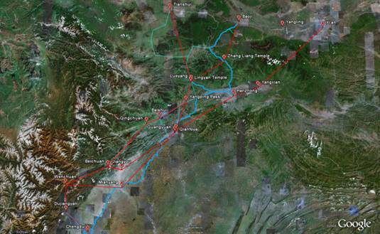
But it is also clear that the full extent and scope of the disaster is still a long way from being known and in many areas the basic human needs for shelter, food, clothing and security (including security from disease) remain the top priority as aftershocks continue to move north into Shaanxi. It seems that the impact on the western part of the area containing Shu Road history and its relics is very severe. I have used Google Earth and added some diagrammatic lines of influence to show how the northern spread of the shocks may be affecting the mountainous areas where the Shu Roads were located. It was done to provide geographical context to the report from Feng Suiping that I have included to finish this section. The KMZ file can also be downloaded from the ACC Project Website if you wish to look at it more closely.
|
|
|
Places mentioned in Feng Suiping’s report and diagrammatic lines (in Red) of possible influence of the shockwave from the three earthquakes along the Dragon Gate thrust-fault. Blue lines are GPS tracks and routes for the western section of the Shu Roads. |
This report also needs an end point. I will make it a recent email from Director Feng Suiping of the Hanzhong Museum in which he provides some initial indications of how the events have affected places which people who attended the Symposium in May 2007 will remember as well as some other famous points on the Shu Roads.
The places mentioned are on the above map but you may need to download the KMZ file to fully appreciate the scope and extent of the damage and its geographical context using the 3D terrain visualisation capacity of Google Earth. Keep in mind that Tianshui in Gansu and Baoji in Shaanxi have also had serious damage and that the aftershocks yesterday (May 27) were located in near the Baozhusi Dam (宝珠寺水库) in Ningqiang Counties to the north of Guangyuan City. People are still in danger.
Email from Director Feng Suiping (arrived May 26, 2008 9:15am):
“David: I will briefly tell you what I know of the situation:
1. On May 12 at 14:28, there was a grade 8 earthquake in the Wenchuan area. Dujiangyan, Beichuan. Guangyuan, Qingchuan and other places have had even greater destruction. Up until now, 60,000 people have died, and 20,000 are (still) missing. Things have moved from rescue to the prevention of disease and resettlement. The biggest problem now is the barrier lakes, the biggest of which is the Tangjiaba barrier lake at Beichuan. However, we (Chinese people) are confident because the PLA is determined to resolve the problem.
2. On May 24 at 16:14 in the afternoon, Guangyuan and Qingchuan experienced the largest aftershock of the Wenchuan earthquake, with magnitude 6.4. Because this was a reverse-thrust earthquake, the destructive power was (even) greater. Hanzhong, Xi'an and Beijing all felt it.
3. The loss from this earthquake is disastrous. It is the largest earthquake (in China) since 1949, and its destructive power is more than the Tangshan earthquake of 1976. Beichuan, Qingchuan and other places have been entirely destroyed and Hanzhong has also had a significant effect. Starting from May 12, I have been on duty, and have not returned home. On both sides of the streets there are temporary shelters, and the Museum has been closed. Of course, we have contributed money for the earthquake disaster, and hope that we can soon rebuild our homeland.
4. Dujiangyan's Erwang Temple has been destroyed; the Huangze Temple in Guangyan has been similarly affected. The Wuyun building at the Zhang Liang Temple is in danger of collapse and many houses (there) have collapsed. A number of cliff carvings at the Lingyan Temple at Lüeyang have been destroyed and buildings are in danger of collapse, the Temple of the River God (at Lüeyang) has significant cracks. In regard to our Museum in the Hanzhong basin region (ie on the alluvial plain), there has basically been little lost.
We have started work again today, with everyone working for a better future. I have attached some relevant photographs from the Museum. Feng Suiping.”
[大韦:谢谢您关心我们震区的人民。现将我知道的情况简要告诉您:
1. 12日14:28,四川汶川地区发生8级地震,都江堰、绵阳北川。广元青川等地破坏较大,迄今已死亡6万多人,失踪2万多人。目前已由救人阶段转入防疫、安置阶段。但现在最大的问题是堰塞湖,突出的是北川的唐家坝堰塞湖。不过解放军千方百计解决,因此我们这些中国人都很放心。
2. 昨天(24日)下午16:14,广元青川发生汶川地震以来的最大一次余震,震级为6.4级,由于这次地震为逆冲地震,所以破坏力较大。昨天汉中、西安、北京震感明显。
3. 这次地震损失惨重,这是1949年以来最大的一次地震,破坏性超过了1976年唐山大地震。北川、青川等地已夷为平地,汉中也受到较大影响。我从12日开始到现在,一直值守,还没有回过家。街道两旁都是防震棚,我馆也闭馆,当然我们也向灾区捐款。众志成城,我们希望能早些重建家园。
4. 都江堰的二王庙被毁,广元皇泽寺也遭到不同程度的损毁。汉中的张良庙五云楼等成危房,许多房子被毁;略阳灵岩寺一些石刻损毁,房屋为危房;江神庙墙体已裂缝。由于我馆处在盆地中,所以基本上没有受到多少损失。
今天我们开始上班,一切都朝好的方向发展。顺便发上有关我馆的几幅照片,再次谢谢您的关心。岁平顿首]
|
|
|
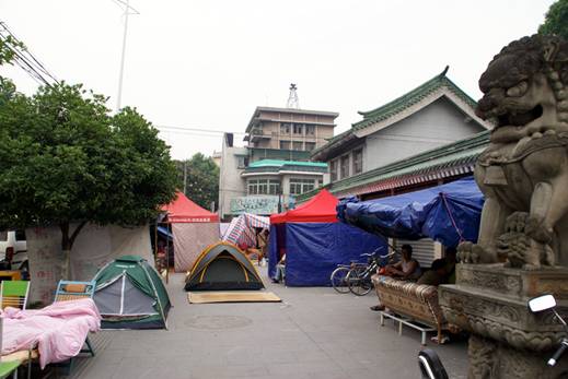
People camped outside the Hanzhong Museum for fear of aftershocks and building collapse. The work at the Museum was also conducted from a tent! |
4 Conclusions
It is clear that the dynamic between China and anyone who is working there and anyone who will work there in the next few years has changed. At the present time there is still an emergency. Basic human needs are the top priority and restoration of support for housing, clothing, food, health and security will occupy first place. For most of us the best option for support is to donate money through a well-known charity organisation. Even China does not have unlimited capacity.
In the future, I believe that China will not step back in its basic and material progress. The needs of the people in the West of China will be met, the games will be held and the long process of rebuilding will begin as soon as it is possible. In Hanzhong I am equally certain that the Museum’s 50th Anniversary will be celebrated, its Conference will be held in November and the Tourist Bureau will consider all the submissions made by foreign visitors. I am sure that our Collected Papers will be published and our collaboration will not diminish. But there are new factors present now and I hope that we can adequately take account of those in the completion phase of our project.
Beyond their fundamental basic needs, Maslow[2] proposed that people need to progress to self esteem and self-actualisation which surely involves employment, income, education, regional economic development and the development of their local living environment. In the wider region of particular concern to us, Chinese and western tourists will need to regain confidence in their safety and reception before they return and experience the culture, the history and the environment. The people’s basic needs can be met, the infrastructure has been badly damaged but it can be rebuilt as can new homes and schools. Self-confidence and a vision for the future may take a little longer and require special support.
This report is primarily a project report but may have a wider circulation. To the Australia-China Council perhaps I can specifically suggest that they and other Australian organisations or agencies that fund activities with China keep some capacity in reserve at this time and in the (near) future, when things are clearer, call for proposals that take account of the events of the past two weeks. Such an action would be a concrete statement of support for China at this time. I do not see that there is now “business as usual” with China. Wenchuan and China’s response to it have become part of its history and culture and influence all of our future interactions with China and especially the west of China.
5 Appendix – Suggestions to improve Hanzhong tourism (submitted to the Hanzhong Tourism Bureau)
To: Hanzhong Tourism Department
Suggestions for foreign tourism to Hanzhong
I have been privileged to visit a few of the many attractions for Chinese and foreign tourists in the Hanzhong area. The attractions include historical and cultural sites, spectacular scenery and places where the unique environment and wildlife can be experienced. Access was a problem in the past but has recently improved greatly with the opening of the Xihan Highway and will improve further in the future. Access to areas along the secondary routes is, however, still hampered by the many trucks travelling from all over China between the north and the south.
Hanzhong has a wealth of relics of past events and the people who have made history. Western people are very interested in the long history of Chinese culture so that these relics provide a significant advantage that will bring people to Hanzhong. For example, the association of Hanzhong with the “Three Kingdoms” period is interesting to people in the West where there is access to translations of the famous novels about these times. From such interest, their discovery of the more extensive cultural richness will enrich their stay. But Hanzhong has not been well known overseas as a tourist location. In China, I believe the interest in the Hanzhong area has increased rapidly, but I think that in the west it is still relatively unknown. My first suggestion is to make Hanzhong and its region better known. This can be achieved through travel and exchange, travel writers visiting, translations of Chinese language introductions into other languages, dual language signs and guides, foreign language web sites, conferences, cooperation with foreign tourist agencies and discounted special promotional packages. I am sure Hanzhong has already embarked on this effort.
Western people are very interested in the environment. It is a great tourist attraction. Many people love to hike on mountain trails and through scenic areas and enjoy “adventure tourism”. These attractions exist in the Hanzhong region. The combination of culture and history with environment and adventure tourism provides Hanzhong with great advantage. Western people highly value conservation and preservation of the environment as a tourist attraction. I suggest that there are some things that can be done to improve their experience. For example, in the Qinling there are places with relatively difficult trails that reach unique scenes and environments. But they are threatened by growing levels of “white pollution” and rubbish. I am sure the Hanzhong government is well aware of this. Having organised rangers and site management can create employment for local people, preserve the environment and increase the number of people able to visit the attractions. In areas that are hard to manage, perhaps volunteers can visit to retrieve and re-cycle the “white pollution”. The added value to the tourist industry and improved sustainability of the sites will be well rewarded.
(Writer: David Jupp, Canberra, Australia, Translator: Xie Hongxia, Yangling, Shaanxi, PRC)
中文:
我有幸到汉中参观了一些吸引中外游客的景点,这些景点包括历史和文化遗址,引人入胜的自然风光,生活着野生动植物的独特地理环境等。过去要进入汉中是比较难的,随着西汉高速公路的通车,通往汉中的交通条件得到了大大的改善,未来还会进一步改善。遗憾的是,到目前往来于中国南北方的货车暂时还不允许走西汉高速公路。
汉中有大量历史遗迹,这些遗迹记载了一系列重大的历史事件和创造那段历史的人物,这些遗迹可吸引对中国历史文化有兴趣的西方游客来汉中旅游。例如许多外国通过阅读三国演义等古典小说译本了解到三国时期的情况,对汉中历史产生兴趣,进而希望来汉中旅游,以便更多了解中国的文化;而为了更好了解中国悠久历史文化,这些游客就得在此停留更长的时间。在国内,汉中的知名度快速提高,然而,在海外汉中还是一个不为游客知晓的城市。我的第一个建议就是通过各种旅游交流、游记作家介绍、编印多种语言的文字介绍、使用双语的导游路标和双语导游、建立多种语言的网站、举办会议、开展中外旅游公司的合作、进行旅游产品促销等让外国人了解汉中。我想,这方面汉中已经做出了一些努力。
外国人很重视环境,良好的环境也是吸引游客的一个重要方面。许多外国游客喜欢远足爬山来领略大自然的景色,也喜欢冒险旅游,汉中拥有众多的就有这样的景点,因此这里拥有优美自然环境、丰富历史人文环境和冒险旅游的优势。许多国外的游客重视环境的保护,因此这里也有必要做一些这方面的工作来增加外国游客在这方面的感受。在秦岭有些相对难以进入的地方有着独特的风景和更加优美自然风光,但是却遭受白色污染和其他垃圾的威胁,我相信汉中政府应该也意识到了这些。通过组织巡逻队清除垃圾和加强遗址管理可以增加当地人的就业、保护环境、吸引更多游客来参观。对于一些管理难以到达的地方,志愿者有可能拣回这些白色污染并使之能循环利用。通过环境保护,旅游景点和旅游产业的整体价值将得到提升,旅游资源可持续利用能力提高,这些必将收到很好的回报。
作者: 贾大韦,澳大利亚
翻译: 谢红霞,陕西杨陵