Collected Tangluo Road Maps, Subsets from the Qing Yan Ruyi Map,
Google Earth presentations and background documents
|
|
|
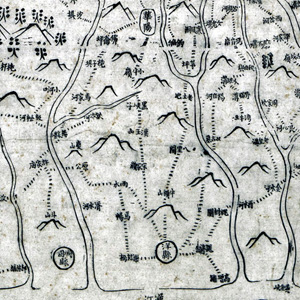
The Map shown above is extracted from a Qing Period map by Yan Ruyi in the collection of the US Library of Congress. For information on how to access the materials and further examples of this and other maps by Yan Ruyi you should go HERE. In the table below you will find three overlapping subsets of the above map that include routes belonging to the ancient Tangluo road network. |
|
The Table provides general access to documents, maps and other background material that has been used to map the various routes in the Tangluo Road network and set up the Google Earth presentation. Maps include Sir Eric Teichman's map from his book, Yan Ruyi's map from 1822 and Russian 1:200k Topographic maps from the 1960's. Also included is enhanced SRTM imagery for mapping terrain elements in Google Earth and also access to the main Google Earth presentation of the Tangluo Roads. The latter two presentations are also to be found in the Google Earth presentation page of this website HERE. Four scanned photographs from Sir Eric Teichman's book are included for context as are various documents providing background to and descriptions of the materials.
References:
三省边防备览,严如熤,张鹏翂编者,1822,十四卷
Li Xiaocong (Ed) (2004). “Summaries of holdings in the US Library of Congress' Collection of ancient Chinese maps”, Beijing, Cultural Press, October 2004. (Chinese and English) Meiguo Guohui Tushuguan Guancang Zhongwen Gu Ditu Xulu, Li Xiaocong bianzhu, Beijing Wenwu Chubanshe, 2004-10. 美国国会图书馆藏中文古地图叙录, 李孝聪编著, 北京:文物出版社, 2004—10. (中英)
Teichman, Eric (1921). Travels of a Consular Officer in North-west China, Cambridge University Press, 1921.
|
|
Description |
Map or Picture Name |
Information |
|
Maps and other resources for Shu Road mapping |
Document describing materials being used to map the Shu Roads and the Google Earth presentations. Overview of the materials and methods. |
|
|
Tangluo Road Main Presentation (Download KMZ as zip file) |
Tangluo Road Main Google Earth Presentation. (View in Google Earth). Includes main route, Teichman's route, alternate routes, towns and places on the way |
|
|
Sir Eric Teichman's Map of his travels in 1917 (JPEG) |
1917 travels through Shaanxi and Gansu by Sir Eric Teichman. Scanned original folding map from Teichman book. |
|
|
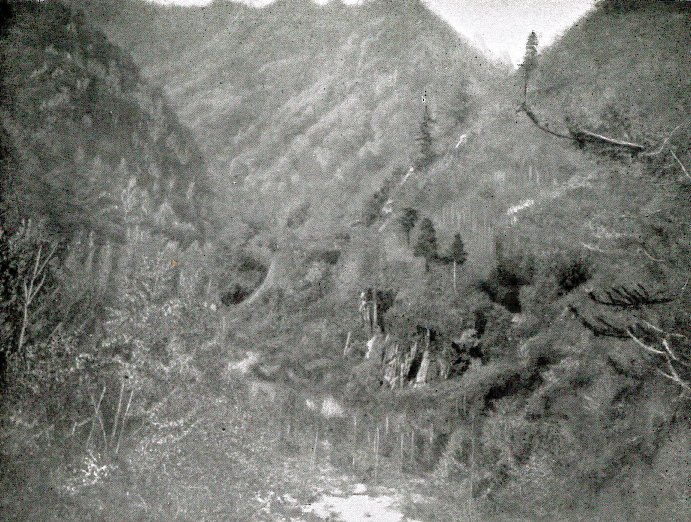
Teichman Plate IX (U) (JPEG) |
Gorge in the Ch'inling Shan (Qinling Shan, 秦岭山) on the trail to Fop'ing (Foping Ting, 佛坪厅) |
|
|
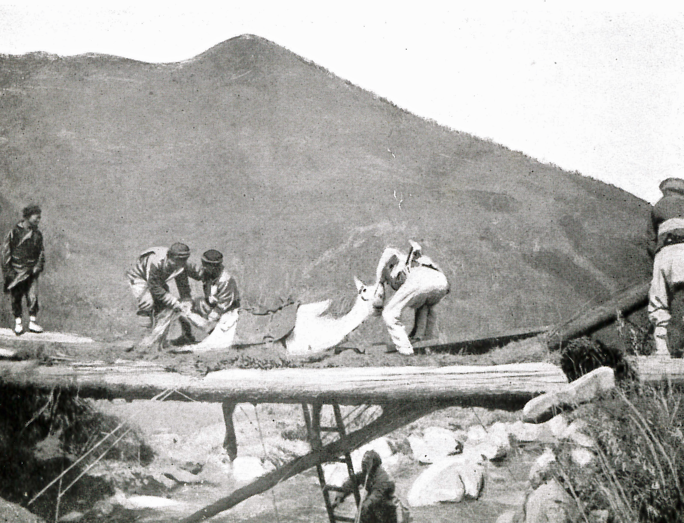
Teichman Plate IX (L) (JPEG) |
Accident to a pony on the Fop'ing trail |
|
|
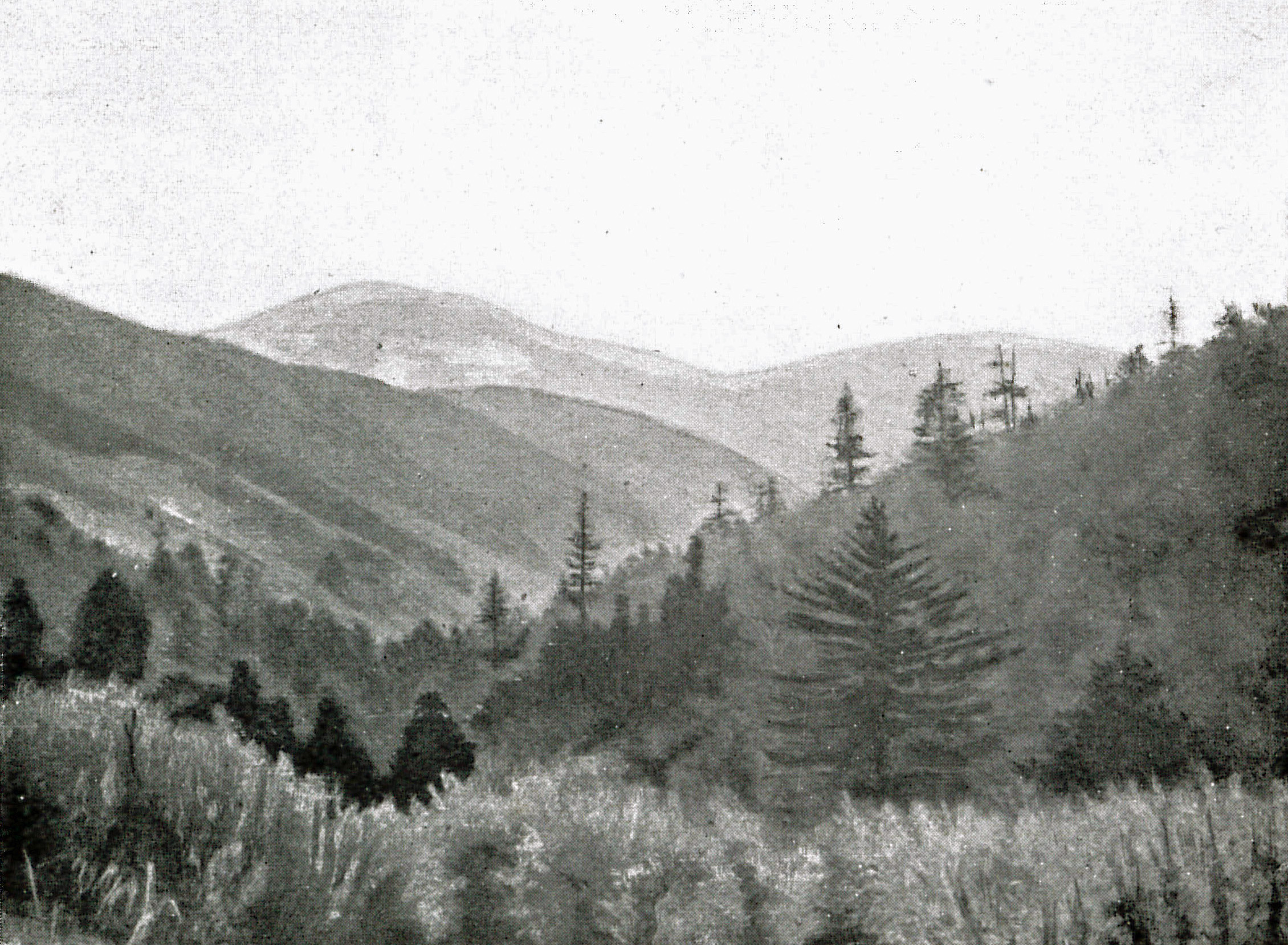
Teichman Plate X (U) (JPEG) |
View from the Hsinglung Ling (Xinglong Ling, 兴龙岭) on the Fop'ing trail |
|
|
Teichman Plate X (L) (JPEG) |
View from the Hsinglung Ling on the Fop'ing trail |
|
|
Library of Congress Ancient Chinese Map Collection (LINK) |
Information about the LoC collection and access to the Yan Ruyi 1820 map of the area north of the Han River. |
|
|
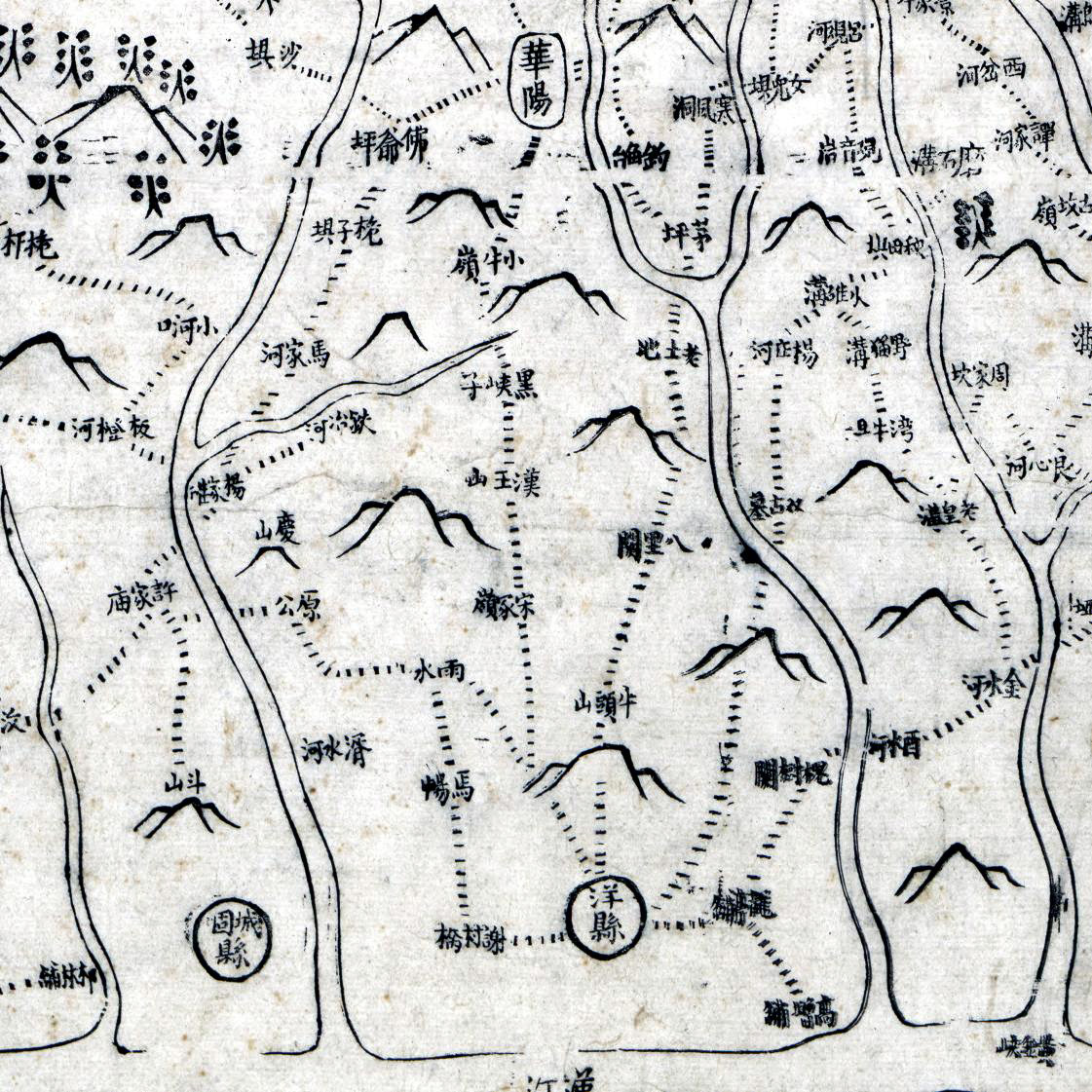
Yan Ruyi - Yangxian to Huayang (JPEG) |
Yan Ruyi Map extract for the Tangluo Road region between Yangxian (洋县) and Huayang (华阳) |
|
|
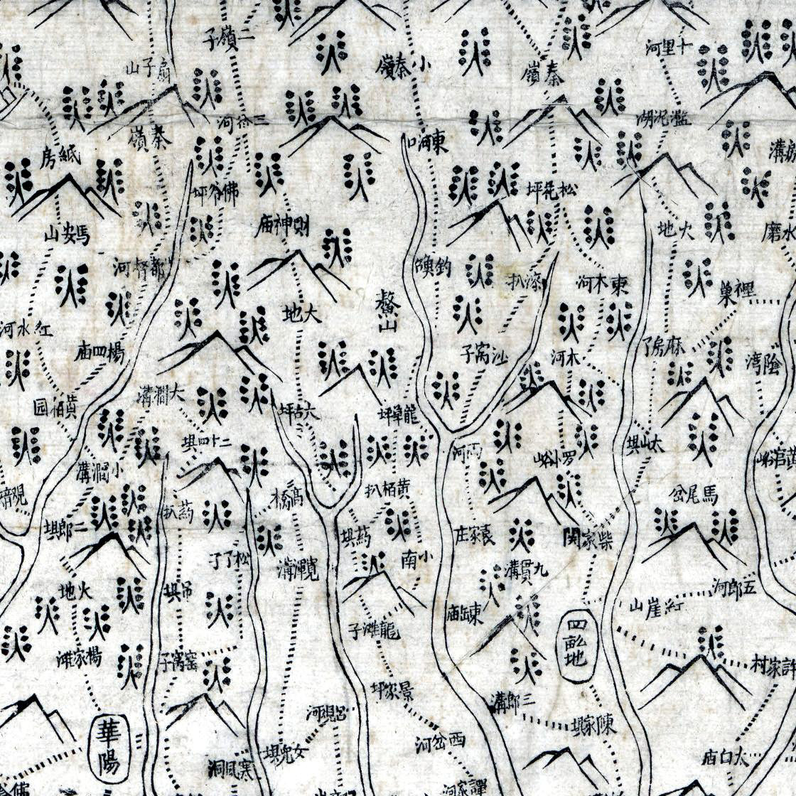
Yan Ruyi - Huayang to Dudu River (JPEG) |
Yan Ruyi Map extract for the Tangluo Road region between Huayang (华阳) and Dudu River (都督河) |
|
|
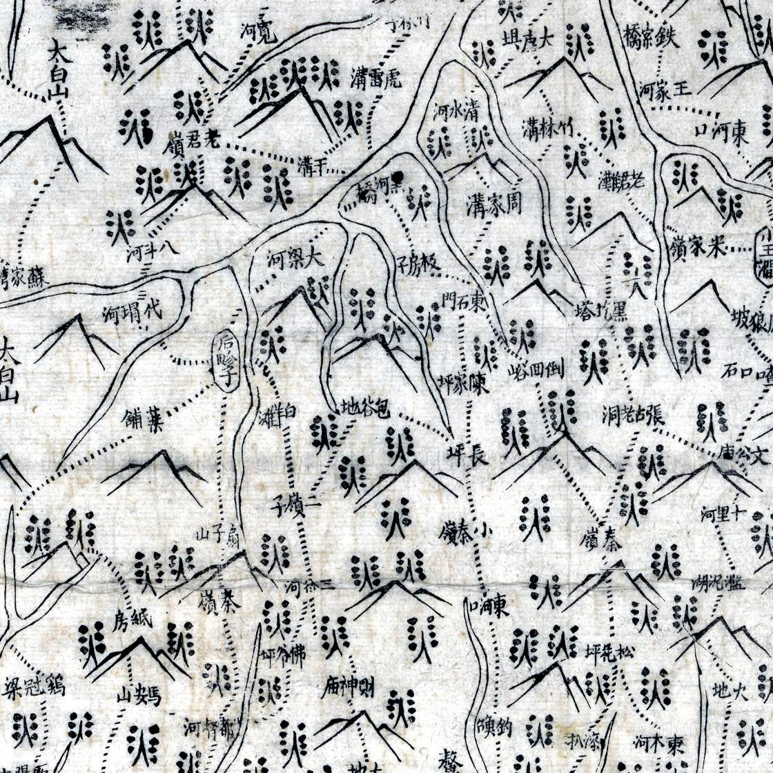
Yan Ruyi - Dudu River to Laojun Range (JPEG) |
Yan Ruyi Map extract for the Tangluo Road region between Dudu River (都督河) and Laojun Range (老君岭) |
|
|
Yan Ruyi - Laojun Range to Zhouzhi (JPEG) |
Yan Ruyi Map extract for the Tangluo Road region between Laojun Range (老君岭) and Zhouzhi City (周至县) |
|
|
GE Terrain for the Tangluo Roads (Download KMZ as zip file) |
GE TLD region DSM enhancement (View in Google Earth). Enhances ridges and streamlines. |
|
|
Russian Map Mosaics at 1:200k |
Description of the Russian maps available to the Shu Roads project, provides background and Palladius transliteration with Palladius to Pinyin Table. |
|
|
Google Earth Russian Maps (Download KMZ as zip file) |
Set of Five Russian maps at 1:200k scale for the central NE (Xi'an) to SW (Chengdu) axis of the Shu Roads. (View in Google Earth). Two NE Maps cover the Tangluo Road and can be used with the TLD presentation. |
|
|
Document |
Document Name |
Description |
|
The Translated Tangluo Road document and Stories |
Teichman on the Foping Trail (EN) |
There are three main documents covering Sir Eric Teichman's travels and associated stories. The original main document was translated for a conference. The translated paper was then developed into matching English (EN) and Chinese (CH) documents which are now the primary sources. Various additional interesting background stories have formed a new document called "Stories from Teichman's Tangluo Road". |
|
Extracts from Teichman's travel log and List of places visited |
Extracted Route from Hanzhong to Zhouzhi along the Ancient Tangluo Track by Sir Eric Teichman. Important resource for mapping the road in Google Earth. |
|
|
Translations of two extracts concerning the official literary account of the Tangluo Road |
Extracts from two books, one is by Prof Li Zhiqin published in 1986 and the other published by the Hanzhong Museum in recent years. Together they provide a summary of the "official" account of the Tangluo Road. |
|
|
English Summary from Fan Wenshi "Pandas of the Qinling" |
A book published in 1988 by Pan Wenshi ( 潘文石 ) on the Qinling Pandas has very detailed information about geology, geomorphology, ecology and environment of the area. The English summary is provided here as introduction to the Panda area and the environment of the Tangluo Road. |
|
|
Translation of paper on the Tangluo Road and Huayang by Zhou Zhongqing. |
Translation of Zhou Zhongqing's paper. Contains routes for the ancient Tangluo Road and alterative routes, historical stories from the Tangluo Road, Poetry from the Tang Period and a discussion of the Qing frontier town of Huayang. |
|
|
Translation of an article on the Tangluo Road by Shui Xiaojie. |
Translation of Shui Xiaojie's article from his book. It describes his wanderings along the Han River with some friends. His views on the area where the Tangluo Road starts in Shaanxi near Yangxian are provided as well as telling historical and semi-historical stories. It is a very interesting read. You are welcome to access it HERE. |
|
|
Teichman's 1921 book from Google Books. |
Teichman's Book, published in 1921 is available as a PDF from Google Books. As it is out of copyright it is at no cost. It has been made available here for the convenience of people wishing to access it for personal research. WARNING - PDF is 17 MB. (Recommend you "right click" on hyperlink and use "Save Target as..." to download). |